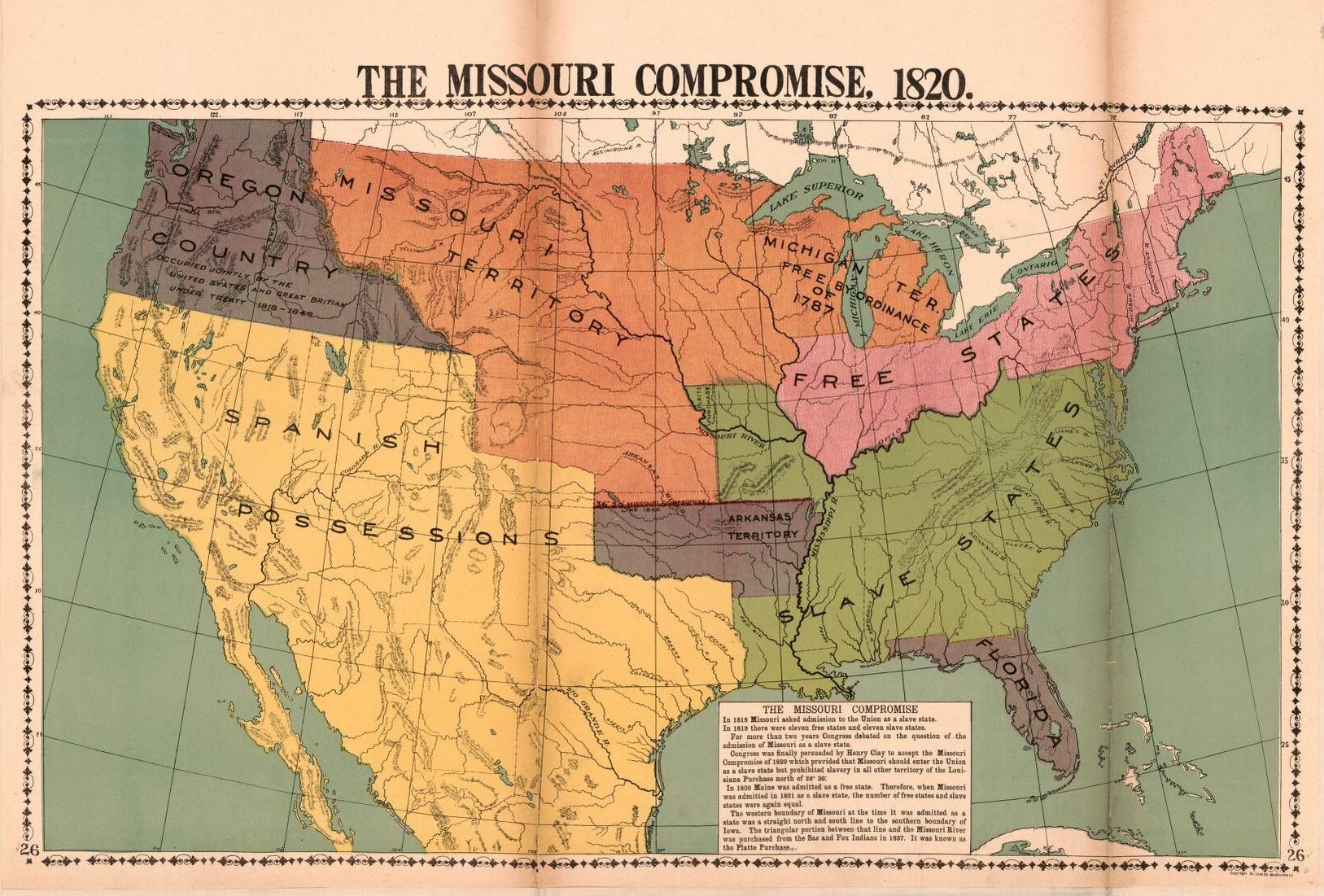
Missouri Compromise Map – LOC Published March 9, 2020 at 1627 × 1101 in Missouri Compromised: Anti-Slavery Protest During the Missouri Statehood Debate / Next → A Map of the Missouri Compromise of 1820. Courtesy of the Library of Congress.
